Barker Peak at Sunrise

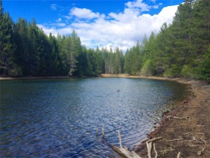
One of my favorite camping spots along the Tahoe Rim Trail is near Barker Pass. At just over three quarters of a mile from the Barker Pass trailhead, it is ideal for bringing along “more than you really need” in creature comforts from your car. Though I don’t cook much on the trail, having a freshly brewed pot of Peet’s coffee from my cone filter (or French press if I get really decadent) is really a slice of heaven while watching the sun rise over the lake.

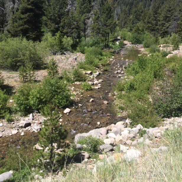
The campsite is listed on Guthook’s Hikes, Tahoe Rim Trail Hiker app on Android and iPhone, as well as the app and maps for the PCT. Most thru hikers don’t stop there as they just came from Desolation or the campsite near Bear or Miller Creek, and the day is still young for getting some miles in. Barker Pass is easily found from Highway 89 at Barker Pass Road (also known as Blackwood Canyon), approximately 7.5 miles from the highway. The last mile is unpaved –  it is well maintained and relatively smooth for even passenger cars to navigate. The last 100 feet up to the actual trailhead is a little rougher, with ruts that might be too much for a passenger car. Best to just park on the east side of the road on a diagonal, and hike the remainder of the way. There are vault/pit toilets at the trailhead, but no running water. (Note: about 1/4 mile past the campsite is a small spring that feeds the Middle Fork of Blackwood Creek. At the time of this writing, it was still flowing well enough to fill up water bottles for filtering)

There is a picnic table at the trailhead in case you want to sit down and have a civilized bite before setting out into the wild. This is a gathering point for many PCT thru hikers and section hikers for re-provisioning before jumping back on the trail, northbound for Canada. (It is easier to get a ride to and from Tahoe City here than it would be to hike into town via Ward Canyon)

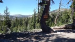
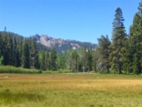
After playing at Donner Lake and Hurricane Bay, one of my fav beach spots on Tahoe’s west shore, it was time to head up the mountain to Barker Pass. We had already eaten dinner so nothing to cook at the campsite. (trying to keep food to a minimum, as bears have been more aggressive foraging for food with the drought) Our hike took about 45  minutes with plenty of stops for photo ops and taking in the sights. We passed through a large meadow of Mule’s Ear behind Barker Peak before arriving at the crest, where the trail and OHV (off highway vehicle) road meet. Finding my secluded little plot, I cleared off and smoothed a perfect spot for the tent. Though I expected to be up and awake before sunrise, I made sure that the tent opening faced east to watch the sunrise in case we were still in sleeping bags at 0600.

Camp is now set for the night, time to get the bear bag hung with the “goodies” for breakfast out of reach of the Yogi’s. This time I didn’t bring my Bear Vault, as we were only going away for one meal’s worth of food. I used Op sacks, double bagged (overkill) and a modified PCT hang in a tree about 200 feet (count out 75 paces) from camp. If he/she could figure out how to get the food down, God bless you Yogi, you deserve it more than I do. (BTW, it was there the next morning)

At just over 8,000 feet, the wind can howl over the pass sometimes. Though it was windy the night that we stayed, the tent didn’t get much wind at all. I stepped outside for a peek at the stars, but went back in shortly, as it was a little brisk at 1:00 AM. Just before dawn, we awoke and made sure we would be ready to capture the sunrise on film. The wind had stopped, but clouds would obscure a perfect sunrise over the Carson Range and Lake Tahoe this time. While I boiled water for coffee, Sara started snapping pics of the sunrise. Now, each of us with our hot cup of coffee in hand, watched the sunrise over the clouds on the eastern horizon. Truly a great way to start your morning…just you, the birds and some hungry ground squirrels.

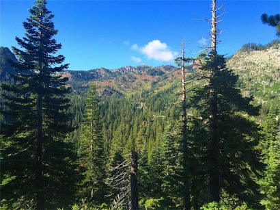
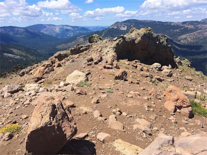
Two cups of coffee into us, it was time for a short hike out to the lava knob to the north, and a get a taste of fresh spring water (filtered of course) from one of the springs that feeds the Middle Fork of Blackwood Creek.  The hike out to the knob is fairly easy…nothing technical, following the contour of the mountain to the knob. (You can go out to the end, but the soil becomes somewhat loose underfoot, and take it slow on the sharp lava rocks.) Out on the ridge-line now, we can see where we camped, Barker Peak, Ellis Peak and Lake Tahoe. To the north, we could see Twin Peaks, where we were several weeks before on a 20 mile run on the PCT to the lake.

Time to pack up and head back to the car. On the way back down the hill, we came upon a young bearded guy, through hiking the PCT. We chatted for a little while, and I noticed that he had an accent, so nosey me asked where from…Israel! Well if that wasn’t interesting enough I asked his trail name and he said “Dorothy”…he chose it because he wasn’t in Kansas anymore! Very clever, I thought.

Time now for a heartier breakfast than a Clif bar in camp, so we got into the long line for breakfast at one of my favorite eateries, the Firesign Café on Westshore Blvd. At the time of writing, there is a new and improved market and deli across the street from the Firesign…perfect for grabbing a bite before heading out to the William Kent Beach.

After brekkie, we did take a stroll to the beach across the street and went for a quick dip in the lake. Not too cold this time, and laying in the sun felt pretty good after the cold water plunge. Good for a couple of hours of free relaxation before heading back down the mountain to UN-civilization.

That’s all to report for this trip…Thanks for coming along.

Until next time, I’ll see you somewhere in the Tahoe Wilderness

TahoeMarmot2 copy-resized copy

Sierra Crest 30k Preview and Race – Donner Ridge to Donner Summit

This time I’m on my way to Tahoe-Donner to preview a trail race I entered for August 8. I volunteered to preview a portion of the course at the request of Race Director Megan and “AB” from Tahoe Mountain Sports in Truckee. “AB” fitted me with a GoPro camera on my chest to record some “action videos” and pics of the trail, to promote the inaugural event. I asked my friend Sara to help me with the trip, as the run I was doing was a “point-to-point” run, and I needed her to pick me up at the end. Sara is also a professional photographer, and contributed many pics to this post.

Sierra Crest 30k Preview Run

AB gave me a crash course in operating the GoPro, but it didn’t work as well as I had hoped…or I didn’t remember what he told me as well as I had hoped (I’m sure you can gather which one went wrong). Problem was, I was wearing too many bloody things on my chest already to add one more… luckily I had my own camera and iPhone for back-up, and Sara took some pics with her camera, so we still got some good shots in the end.

The first part of the course started at the Tahoe-Donner Equestrian Center and encompasses the vast Tahoe-Donner trail system, in summer months, mostly horse traffic. We opted to bypass this section in favor of a quicker, shorter, more picturesque section, that of Glacier Way to the Donner Lake Interchange (west-bound offramp for Donner Lake from Interstate 80). This is where Aid Station #2 will be. Trailhead #24 at Glacier Way on Donner Ridge was a beautiful, regional park location for the Aid Station #1 for the run. The pretty park-like sitting is probably used only by locals as there are no toilets or trash receptacles that we could see.

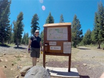
At the trailhead, there was a trail map of the entire system, but more than we cared to digest in the amount of time we had to get it done, and get the camera back to AB before the store closes. I did have  my GPS’s on my iPhone and my new Garmin Epix watch to guide me.

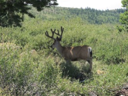
After making it to the ridge and I-80 overlook, there were few choices of trails, so little chance of getting lost. Sara and I ran for about one mile together until we reached the Negro Canyon Overlook Trail sign. From there, she doubled back to the car while I continued on down the hill. On her way back she snapped a picture of a buck grazing, seemingly unfettered by her presence.

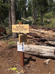
At the Negro Canyon sign, I was conflicted as the sign said that the trail ends. I watched a single mountain biker pass me, and I waited for him to turn around or continue on, to see what to do. As he pedaled into the distance, I followed assuming this must be the way.

Finally the trail matched up with my GPS’s, and I was on my way down the trail.

Donner Ridge Preview from Tahoe Marmot on Vimeo.

Switchbacks down face of Donner Ridge from Tahoe Marmot on Vimeo.

I did come to a trail marker for the Donner Lake Rim Trail that was laying on the ground, not instilling a lot of confidence in me. There was a bushwhacked trail next to it, so it was a little confusing which way to go. After a little scouting, I found the correct trail and continued on. This brought me to a 4-way junction, but this time the markers were in their proper place. I followed the trail over the face of Donner Ridge and along the switchbacks, taking in the incredible views and panoramas with both cameras.

I made my way down the mountain in good order. The trail was in great shape but I still took my time getting down, taking in the beautiful day, and the sights and smells of the trail. Sara was picking me up at the Donner Lake Interchange off of Interstate 80, where the Aid Station #2 would be. This part of the course is a perfect 2-4 hour run or hike, with great views and no technical climbing. You would have to plan ahead and have someone pick you up at the Billie Mack Rd. parking area, or leave a car at both ends of the trail.


Sierra Crest 30k and 50k Trail Race Aug. 8, 2015

Now for the day of reckoning, the race itself. Over 70 entrants will be racing two slightly different courses, mostly over common terrain. We will all finish at the Auburn Ski Club’s Lodge at Boreal Ridge near Donner Summit. Race Director Megan Seifert and Glenn Jobe from the Auburn Ski Club put on a well organized, well marked and staffed event for their first attempt. I met several new friends prior to the start, all accomplished trail runners eager to get on the trail as much as I was. Pre-race briefing was on Friday at Tahoe Mountain Sports to get last minute instructions for tomorrow’s start and to pick up my race bib number. On race day morning at 0630 many of us met to take the shuttle bus to the starting line, as this was a point-to-point race, leaving our cars at the finish. We all gathered at the starting line at Tahoe-Donner Cross Country Ski Resort (15275 Alder Creek Rd, Truckee, CA 96161) The 50k runners were off one hour before us in the 30k. Their course took them through the Euer Valley, beautiful, mostly level terrain, making them run an additional 20 km, about 13 miles.

Now it’s time for my group, and we’re off…well they are off like a shot. I’m going to be be gasping for a while, trying to get my heart and lungs accustomed to less oxygen for the next seven to eight hours. I didn’t seem to mind some of the younger folks passing me early on, but when one spry older 74 year old lady left me in the dust, I was a little crest fallen. This first section of the course was previewed by fellow Donner Party Mountain Runner, Jon Murchison, forewarning of the 2,000 feet of climbing in the initial seven miles. The climbing never seemed to end in some spots, but the higher I got, the views steadily became more picturesque as the morning progressed. I was far above the fog that enshrouded Donner Lake and parts of Truckee. The rains from yesterday’s thunderstorms knocked down much of the trail dust, making for ideal trail conditions.

Finally at Aid Station #1 at Glacier Way, where Sara and I scouted out the race two weeks prior. Grabbed some fresh water and electrolyte drink, a few munchies, and off on the section of the trail that we previewed. At least this section, I knew what to expect. Tried to keep up with some of the people I met at the Aid Station, but they were mostly locals and had the altitude jump on me.

I made it to the second aid station at about 12 something, long before the cut-off time…but my most difficult hill was just coming up after that. A gnarly 4×4 road, with ruts as deep as canyons, loose sandy steep footing, and in full sunshine took it’s toll on me. After more climbing back up to the next ridge, another runner in the 50k came from behind and was becoming as weary as I was. It was a relief to have some company on this arduous part of the trail and co-miserate a little. Chris and I became running partners, encouraging each other to finish what we had started. Neither of us had any intention of throwing in the towel, and we had each other’s back on that.

We did take the time for a few selfies at Summit Lake, and enjoyed the view for a few brief moments before getting back into jogging mode. By this time my left knee felt like I had an ice pick jabbing me with every step I took. My running form was now something akin to Festus on Gunsmoke, hobbling down the trail, trying to keep up with Chris and not hold him back any more than necessary.

Not far from Summit Lake, one of the Medic’s on a mountain bike came by, sweeping the course for those of us near the end. I assured him that I was ok and fully intended to finish the race under my own power. After a few more of his check-in’s with me, I thanked him for his concern but that I was becoming increasingly annoyed by his hovering…so carry on, go grab a beer at the end and I’ll be along “whenever” dude! Just before the last aid station, two other runners in the 50k we catching up with us…they were at the back of the pack also, giving it their best and enjoying every minute of it as Chris and I were. One of the guys was wearing a running kilt (a first for me), and the only two other people using trekking poles. We’re finally crossing under Highway 80 now, getting big cheers for the last volunteers on the course (probably they’re just happy that the last guys are finally past and they can go get a beer now and go home). The course for me would have ended at the Auburn Ski Club, but I had given Chris my word that we had come this far together, we were going to cross the finish line together as well. Another 1.5 miles to go, so that Chris could complete his full 50k, tacked on another one and one-half miles for me that felt like five miles. After the last few humps in the road the finish line was in sight, with cones, flags, and ribbons still left up until we crossed. Chris and I had a few pictures of us together along with his 12 year old son…we hope to get copies of the momentous occasion soon from the race people. No one waiting for me at the end…just have to be happy with the fact that I survived and completed what I promised myself I would do, pain or not, I finished the 30k and then some.


R&R after Trail Preview at Donner Lake with Sara

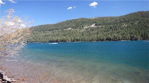
After my run, we headed down to Donner Lake for some lunch and a dip in the cold water. Sara went in, I was too chicken with the icy water…should have in hind-sight. It was still such a beautiful day, and we had a little time to get the camera back to AB at Tahoe Mountain Sports. Found a nice parking spot in the shade and a short hike later to one of the public piers at Donner Lake and we were happy as clams. A few other ladies were the only other ones on the pier and they didn’t mind sharing some of the dock space with us. Sara was brave enough to get into the chilly water, but also seemed happy to get out and sit in the sun after. Never want to leave whenever I am anywhere in Tahoe area. Must say, I am becoming quite found of the Donner Lake and Truckee area as a place to live rather than the hustle and bustle of Lake Tahoe. Still have so many favorite spots around Tahoe though…just adding to my ever-growing long list of favorites.

See you again soon, on my next adventure in the Tahoe Wilderness

TahoeMarmot2 copy-resized copy

Five Lakes – PCT – Stanford Rock Trail to William Kent Beach Trail Run

I’ve been excited for over a week now, getting ready for a long trail run in Lake Tahoe with my trail running club, the Donner Party Mountain Runners (DPMR) and my friend Sara. Sara just kicked cancer’s butt two weeks ago, and now she was ready to go kick some butt on the trail in the Sierras. The route was designed by Chris C. from our club, but he’s a kick-ass mountain runner that lives at 7,000 feet year ’round. We had some pretty tough climbs on this route, with our hearts in our throat the first couple miles to the ridge. The rewards from all of our hard work paid off though, with unbelievable vistas and panoramas of the Lake Tahoe Basin and Granite Chief Wilderness.

Since we were meeting at the trailhead at 0745 in the morning, with a start time of 0800, we needed to be up there the night before. The closest place I could get to the Five Lakes Trailhead in the Olympic Valley near Alpine Meadows ski resort was Donner Memorial Campground. It was nice, but expensive for what you get. My senior discount didn’t help much with the State Parks. With the drought, the showers were only turned on Thursdays and Saturdays if I recall.

That afternoon after making camp, we took a dry run to the Five Lakes Trailhead. It was several miles up the canyon from Highway 89. When we got there, some men were repairing and cleaning up the trailhead from the recent rains. A good 20 minutes travel time to the trailhead from the campground, I gave myself 30 minutes to get there in the morning.

Rise and shine, revellie at 0600…we arrived at the trailhead at about 0740, with members already getting ready to hit the trail. After a few formalities, getting the trail map (somewhat useless…too tiny to read) and signing the waiver, we all amassed for a group photo before heading up the hill. And it was literally “UP” the hill. Not living at altitude and trying to run right out of the gate is tough. I was wearing my heart rate monitor, but no need to look and see where my heart rate was…I knew where it was…it was in my throat! The good thing about having to stop so much is that you got to look around and enjoy where you are, take pictures, smell the fresh air and lavish in my element.

Agony led to ecstasy when we finally reached the ridge. Great views to look back on at the trail junction of Five Lakes Trail to the PCT. We’re now are hiking downhill just to make the hike back up the hill with switchbacks ad infinitum. Crossed a small stream, the outflow from Five Lakes. There were a couple of Northbounders off the PCT camping near the creek as we passed. Now for the climb to the ridge-line. Switchbacks…many switchbacks. Sara was not fond of them and preferred a ladder so we could get to the top quicker.

We finally reach the ridge line, and are treated to incredible views in every direction. We can now catch a glimpse of Tahoe to the east, Alpine Meadows Ski Resort below us, the Granite Chief Wilderness to the west, and Desolation Wilderness to the southwest.

There was a cool breeze on the ridge to keep us cooled off, which became cooler when we stopped for a rest or a bite. I made sure Sara was eating something, as we couldn’t afford for her to “bonk” up here…it was a long way back to civilization. When you are on long distance legs of a trip, you have to force yourself to eat and hydrate before it’s too late. We both took SaltStick also for electrolyte balance as well. The problem with this course is water sources – the first source was about 5 miles in, when you have enough water – and the second was at Ward Creek, less than 2 miles from the finish at the lake. We had room for more water, but you have to draw the line about how much you’re willing to carry sometimes. A heavier pack can also mean less enjoyment along the way, so you decide. If I did it again, I would throw in one more 20 oz. bottle for insurance.

Though we could see Twin Peaks from Ward Peak, it seemed to take eons to get there. We met up with several “Northbounders”…most very nice…some chatty like “Driver” and his pretty wife “Pit Stop” from Mississippi that found a common language with Sara. They were on a thru-hike on the PCT, and were holding up very well. Others on the trail very focused, or withdrawn, or just plum tuckered out and didn’t have much to say.  Oh well, it’s all good.
We finally found ourselves on the backside of Twin Peaks and our waypoint, turning  onto the Tahoe Rim Trail from the Pacific Crest Trail. I had been here last year in June with the snow at Twin Peaks, but the trail was obscured by snow and debris, I never got to summit the peak. Sara was much too tired and we were so far behind schedule, it would have to wait for another time once again. (I never need much reason to come back and do it again)
Once again on the saddle between Twin Peaks and Stanford Rock, we could see down into Ward Canyon, where the Rim Trail continues. It may have been easier climbing-wise for Sara, to take the TRT down the mountain, but it was longer by at least one mile. One more mile I didn’t know if she had in the tank. We continued on to Stanford Rock Trail, which was a steep and loose climb. We stopped and waited for about 8 MTB cyclists on the way down the hill – it was very steep and they needed all the room to keep from doing an “endo” on top of us.
The climb to this ridge was tough, especially when you’re really getting trail-weary. When we finally could see the lake, it looked miles away at best.
The trail drops in altitude very slowly, so we didn’t feel like we were advancing to our destination very quickly. Switching directions, back and forth, we felt like we were in a mouse labyrinth. I tried to cheat a little for Sara’s sake and make it to Ward Creek Blvd., and get her to hitch a ride to the end. Poor thing was spent, but kept at it and never gave up until she accomplished her mission. We finally made it to Ward Creek, but needed to find a way across. There was enough water flowing to get our feet and shoes about one foot deep in the cold water (which really wouldn’t have been such a bad thing at this point). We extended our trekking poles and chose our rocks carefully to make it across with no trouble.
Once back at the road, we tried our luck with hitch-hiking our way back to the beach, so we could hopefully get a ride back to the car in Alpine Meadows. (I know that I couldn’t get a ride if my life depended on it here in Tahoe…I know, I’ve tried it several times and failed miserably. Nobody picks up old guys, even with pretty legs) But a pretty young woman with her thumb out is another story. After several attempts, one local guy with his friendly dogs in the van stopped and gave Sara a ride to the beach area where we were supposed to meet our friends to get back to the car. There was only room for one in the van with the dogs using up more than their fair-share. No problem, I still had a little left in my tank to get back. Finally, Sara and I met up at the beach to find that nobody had waited for us or left word that they were coming back at anytime soon. It was now after 6PM and we needed to get back to the car somehow. I finally reached one of the run organizers and had her come back to get us, all the way from Truckee.
Looking back it was quite a day, and Sara had much to be triumphant about. Two weeks prior, she had kicked cancer’s butt and today she kicked some big mountain butt in Tahoe. Much to be proud of, and bragging rights to boot!
In the immortal words of Peter Quincy Taggert…
“Never give up…never surrender!”
Now it’s time for a little kick-back time at the end of the long day with a campfire, some hot cocoa and of course peanut butter for me…a staple for us Marmots.
Tomorrow we head for Barker Pass for a short hike and view from one of my favorite campsites. Many flowers in bloom this time of year so we’ll be taking pictures of some of the plants in this section of the Tahoe Rim Trail.

Until then…I’ll see you on my next adventure,

somewhere in the Tahoe Wilderness.

TahoeMarmot2 copy-resized copy

Castle Peak

On the first day of summer, we’re off to Castle Peak, just north of Donner Summit off of Interstate 80 to the north. You can see it towering above the highway as you approach Donner Summit from the west. There are many ways to get there from I-80. I took this route today as I was eastbound to Tahoe City eventually. Take the turnoff for Boreal Ski Resort and turn back under the highway driving north. You will see cars parked along the road, but do notice the no parking signs for part of the road. The paved section ends in several hundred feet, then becomes a dirt access road for four wheeled vehicles.

This about 4+ hours, 7 to 8 miles for an Out-and-Back, or loop, depending on your choice of routes. Once at Castle Peak, you can either double-back on your tracks or continue on to Warren Lake Trail to Summit Lake Trail, returning to the Rest Stop on the north side of Interstate 80.

Castle Peak Summit: 9,103 feet

Distance: 7 to 8 miles

Time needed: 4+ hours (Less if you’re not chatty like me)

Elevation gain to the summit: 1,890 feet

(Note: An alternate route would be from I-80 westbound, starting from the Rest Stop area. Join the PCT behind the restrooms and West Lakes, hiking in the northwesterly direction until you arrive at Castle Pass)

(Click here to view GPS Track and download GPX or KML track in Google Earth)

Click here for Topographic map of area

This route is a mecca for mountain bikers, four-wheelers and hikers alike. It is also a popular snow-mobile road in the winter time. The road is wide enough for everybody to enjoy it at the same time. The road starts off with a gradual climb to a fork in the road. There on your right, you can see Castle Peak above you, our goal for the day. If you continued on the road to the left, it would also take you to Castle Pass, where the  trail meets with the PCT. Branching off of the access road to the left is “Hole in the Ground” trail, routing you beneath Andesite Peak, eventually meeting at Castle Pass as well.

We will cross Upper Castle Creek several times on this route. Only a little runoff at this time in our drought year. It is flowing well enough as a water source for drinking after treating or filtering. After another quarter of a mile, the road intersects with the PCT or continues straight on the Donner Lake Rim Trail. Mountain bikes usually continue on to the Rim Trail, but we will be turning left to join the PCT to Castle Pass.

Castle Pass is great place to meet other people out on a day hike or thru hikers on the PCT, on their way north. Today I met up with a fellow seasoned hiker and Grass Valley local, “Mountain Goat”. She had been camping at Paradise Lake, on the other side of Castle Peak.

After a brief chat, it was time to get the show on the road. The terrain changes quickly here, from an earthen soil on the PCT to crushed and powdered volcanic ash. It can be a scramble up the hill with rocks and volcanic ash, not a great footing. I met several solo hikers and small groups coming back down the mountain for the saddle below Castle Peak. It is a good place to stop and rest and enjoy the view or continue on to the summit.

Once at the saddle below the peak, you can take in the panoramic views.


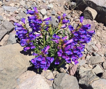
Take time to look around you and enjoy the moment… you see some flowers that aren’t everywhere in the Tahoe Basin. Some of these flowers grow in areas with volcanic soil, like here, Ellis Peak or Barker Peak. The brilliant deep purple Showy or Sierra Penstamen is everywhere here. Wolley Mule Ears, with it’s yellow daisey-like flower, the white, three petalled, and low-growing Smokey Mariposa or Mariposa Lily by another name… Firecracker flower (a type of phlox or gilia), and yellow Marumleaf Buckwheat.

I got a late start today driving up from the bay, so I only have time to climb a little more. The trail becomes steeper and more loose in traction. My Altra Olympus trail running shoes are really not the best choice today. A shoe with a Vibram sole might be better in this section. As I climb higher, Round Valley below me is lush and green. The PCT follows the meadow on the western edge. The Peter Grubb Hut, owned by the Sierra Club is there for PCTers for shelter on their way north. Our Donner Party Mountain Runners have used it in the winter time as a ski-in or snowshoe-in for overnight outings. Reservations are needed. 

Can’t peak out today, time to head back down the mountain and drive to Tahoe City for the night. This was a great way to spend the first day of summer, out in my element…the Tahoe forest.

Hope you enjoyed the trip today. Whichever route you take, you will really enjoy the scenery…it’s some the best views in the Truckee-Donner area.

Until next time…

See you on my next adventure…

Somewhere in the Tahoe Wilderness

TahoeMarmot2 copy-resized copy

Ellis Peak from Barker Pass

This is my second day of running, hiking, climbing of a two day jaunt up in Lake Tahoe. I came up this time for a variety of reasons, one to see a friend that I hadn’t seen in a year, but she bailed before I got up there. (I was not very happy) This week also started the Alpenglow Mountain Festival, sponsored by Alpenglow Sports of Tahoe City. There were a week’s worth of outdoor activities planned, such as SUP (Stand Up Paddleboarding), yoga and trail running. Speaking of trail running, I met up with my friend Robert Rhodes of Bay Trail Runners, who was showing his acclaimed, Trails in Motion Film Festival, the premier trail running and ultra-running film tour at Tahoe Art Haus and Cinema in Tahoe City. I know it was a sell-out crowd…you can look for all of them listed in Bold on Facebook.

This trip is to Ellis Peak, a 8,740 foot peak that is just west of the Homewood Ski Resort. Just 11 miles from the Tahoe City “Y”, we turn right on Barker Pass Road, just at Kaspian Campground, and drive up Blackwood Canyon. There are signs several miles up the road for you to bear left and continue up to Barker Pass. When you come to the second green iron gate, the pavement ends. Find a good spot to park off of the road, as the trailhead is just on the other side of the road. (Note: if you continue down another mile, you will find the Barker Pass PCT/TRT Trailhead parking area, with vault toilets if needed.)

It is approximately a 6 mile out-and-back to Ellis Peak, with approximately 1,700 feet of climbing. If this will be at a hiking pace, give yourself about 4 hours overall. It is quite steep in sections, and with the altitude, expect to take many breaks. Not a problem, as there is so many beautiful things to see in any direction you look. Right now, the first day of summer, the wildflowers painted a brilliant palette of color over the ground and hillsides. This hike can be dog friendly if you bring extra water along for them. It is a dry hike, unless you venture down to Ellis Lake, adding at least another 2  miles to your outing. (I did meet some folks with some dogs, and the older dogs were not very happy…it is a strenuous hike for all, so keep them in mind.)

View GPS Track on Gaia here (If you have Google Earth, you can download the track and flyover on satellite. You may also download a GPX file to use on a GPS receiver)


The hike begins straight up the hill right out of the gate. Several open sections of full sunlight then back into the shade as you switch back up the hill to the first plateau. From there, all of Desolation Wilderness opens up before you to the west and southwest.

To the west, you can easily see the largest lake in the area, Loon Lake, which lies just outside of the Desolation Wilderness boundary. (We will save that track for another day) As I reach the ridgeline, the trail runners from this morning’s Alpineglow Mountain Sports run were coming back down the mountain from Ellis Peak. It was nice to see some trail runners from Germany and Norway enjoying our Lake Tahoe trails and spectacular views.

The trail continues to climb for another half mile or so before reaching the crest and turning down hill once again on the backside of the mountain.

Eventually, the road Intersects with a forest service road and the trail down to Ellis Lake at about 8300 feet, and the 3 mile mark. Now you’re in for a little heart pounding climb up the gravelly hill to the base of Ellis Peak. Now you’re just behind and above the Homewood Ski area. (Note: if you would have turned to the right on the Forest Service Road, it would have brought you down to Lake Louise and the top of the ski lift at Homewood) Rest assured, we’re almost there…just a few hundred more feet and it will all be worth the effort.


The trail is composed of mostly broken and powdered volcanic rock and ash…not the best traction at times, so take it slow. Finally the peak is in sight. A mound of rocks that looks like a chair, and a breath-taking 360° view of everything! The entire Lake Tahoe Basin and beyond lies before you…and to the southwest, all of Desolation Wilderness, still with snow of some of the northeast facing facets.


On my way back down from the peak, I met a young guy with a sweet mountain bike that PUSHED it all the way up the hill so he could ride back down the mountain from Ellis Peak!!! Now that is a die hard!

About a mile or so down the road he came whizzing by with a big smile on his face that he did it…well, a couple more miles but he’ll be there in no time. I also met some people that brought their dogs up with them…out of the 4 dogs, only one looked like he was having fun. It was pretty warm today.

Well, I’m to that valley now between the two mountain tops…rats. This means I have to start climbing again…and after yesterday’s climb to Castle Peak, I’m toast. I can’t wait to get back to the lake and jump in and have a swim.

One last look over the edge of the cliff into Blackwood Canyon, then back to the car soon. Two days of some intense hiking/running/climbing… Now’s time for that swim.


Thanks for coming along…until next time…

See you soon, somewhere in the Tahoe Wilderness

TahoeMarmot2 copy-resized copy


Tahoe City to Ward Creek, Tahoe Rim Trail Run

Gorgeous weather was in store for Lake Tahoe this week and I was lucky to tag along with my friend JoAnne to Tahoe City. While she was attending a seminar for the Ross Valley Fire Department, it would give me enough time for a leisurely run/hike on the Tahoe Rim Trail to Ward Creek and back. Before starting my trek, we ventured behind the Tahoe Dam and Gatekeeper’s Quarters, where there should be water…but not this year. This year the area behind the dam is bone dry – the lake behind the Gatekeeper’s Residence has been replaced by a field of Crest Lupin, beautiful purple flowers that grow out to the water’s edge, some 100 meters away.

The TRT Trailhead starts on the west side of the bike/foot bridge that goes over the Truckee River. Depressing to see what little water is flowing for businesses like river rafting and restaurants along the Truckee. I only hope they can survive the season.

Just over the bridge is a nice picnic area with tables in the shade of large pine trees. Parking is abundant for beginning your TRT section or biking along the Tahoe Bike Path. Outhouses are nearby for any last minute needs.

This section is just under 6 miles with about 976 feet of elevation gain. It is kid and dog friendly on a leash (leash for kids optional). The trail follows the Truckee River northward for a short time before ducking into the forest of pines and cedar. (Click here for a satellite view of the section route)

From there, the trail switchbacks up the side of the canyon, following the contour as you climb away from the Truckee River. Flowers are in abundance along this section of the TRT. The bright “Daisy-like” flower of Mule Ears and the lavender blue of Stickseed flowers lined my path.

As the trail turns to the south, the first of several meadows come into view.

Not easily accessible, it’s best to wait for Page Meadows. Finally, after the last grove of trees disappears, the scene opens to the sprawling panorama of Page Meadows, perfectly showcasing the volcanic monoliths of Twin Peaks and Ward Peak in the distance.

The concrete “Boardwalk” placed there by the volunteers from the Tahoe Rim Trail Association, help keep the trail open during soggy months, insuring that the trail will still be there the following season. Once on the other side of the meadows, the trail once again finds it’s way back into the forest.

Meandering in and out of direct sun, the shady sections are welcome in the noonday sun. Several steep sections arrive just before the end of the trail segment. Forest Service Road 15N60 is a wide and a fairly steep climb or “glissade” over dirt and gravel, depending on which way you are going. There are several last distant views of Ward Canyon and mountains behind. The service road continues straight, to intersect with Ward Creek Road further east. The TRT trail, branches off to the right, towards Ward Creek Road, then crosses it to join the TRT Ward Creek to Barker Pass Segment. There is ample parking along the road on Ward Creek Road near the trailhead for either section of the TRT you wish to do.


A couple of bonus pictures on my way back to Tahoe City… The “New” William Kent beach area that has been under construction for more than one year is now open…with flush toilets and picnic tables in the shade and a very nice, but small, beach to bask in the sun. Parking is limited, so be patient or prepared to walk a few blocks. If you’re hungry, one of my favorite eateries in Lake Tahoe is just across the highway, the Firesign Café.

Thanks for riding along with me…until then…

See you on my next adventure, in the Tahoe wilderness

TahoeMarmot2 copy-resized copy

Shirley Lake Trail to High Camp, Squaw Valley

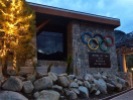
For one of the best day hikes near Lake Tahoe, take a road trip to Squaw Valley, CA, the site of the 1960 Winter Olympics.

Very popular, so expect crowds during peak spring and summer months. It seems that all of the hotels send their guests here, so plan to leave before noon to avoid the bulk of the groups, kids and dogs.

When to go:

This is a great late Spring to late Fall trip, as there are many areas of snow on north and north-east facets into early June.

How to get there:

  • Take I-80 to Highway 89/Truckee Exit 185 and turn south toward Lake Tahoe.
  • Drive south for 8 miles, turn right on Squaw Valley Rd.
  • Follow the road until you arrive at The Village at Squaw Valley , 1750 Village East Rd. on your left
  • (An excellent place to stay BTW, and a good place to buy food for your hike).
  • Trams rides are free from High Camp back to the village (nice!)

Check with squawalpine.com or dial 1-800-403-0206 to confirm Tram schedule

Distance to Squaw Valley from:

  • Reno                 43 miles
  • San Francisco  196 miles
  • Sacramento       96 miles

From the parking lot at The Village, walk to Squaw Peak Rd. (if you see the PlumpJack Squaw Valley Inn, you’re in the right place)

Follow the road looking straight up at the mountain with Tram tower above you for about 0.5 miles until the apex of the cul-de-sac. There you will see the sign for the Shirley Lake Trailhead.

What to bring:

  • Good hiking shoes or trail running shoes (regular tennis shoes not recommended)
  • Trekking poles (highly recommended)
  • Small backpack with hydration or several bottles of water
  • Snacks or lunch (REMEMBER TO PACK OUT ALL YOUR TRASH)
  • Sunscreen, hat, sunglasses
  • Light jacket and packable rain jacket (weather conditions change very quickly in the mountains)
  • Camera
  • Optional: Water purification system like Sawyer or MSR so you can filter that ice cold, refreshing mountain stream water right into your bottle and “taste” the entire experience of your hike.

What to expect:

  • This is a MODERATE hike – Give yourself 3-4 hours overall if you plan to take many pictures and breaks
  • The trail starts off fairly flat, but transitions quickly from a lush green forest to steep granite slabs – when you arrive at High Camp, you will have climbed over 2,000 feet in elevation.
  • Remember you are at altitude – you are starting at 6,200 feet above sea level, climbing to 8,200 feet in under 4 miles
  • Conditions change quickly in the mountains – let someone know when you are leaving and when you expect to be back
  • Many wonderful views, photo ops, wildflowers (Mule’s Ear, Corn Lily, Squaw Carpet, Mesquite) and critters.

Click on this link for a GPS track of my trip:  Shirley Lake Trail and High Camp, Squaw Valley

Let’s hit the trail…

From the trailhead, the trail is marked with blue spray painted lines and marks on rocks and sign posts to indicate your path. The path follows Squaw Creek, as it climbs quickly into Shirley Canyon, displaying many waterfalls and cataracts along your path. The creek will be on your right side ascending most of your trip.

In early Spring, California Snow Flowers pop up under pine needles in shaded areas along the trail. Rich loam of decomposing trees resemble a park-like setting. Soon the path finds the water, at it’s a real treat when the water is flowing. Dogs make a mad dash to be the first ones in the water, only to come find me soon after to rub on.

I usually hike alone, but this time I made an exception. My friend Sara really needed to get out of town and unwind – and I needed get back into my element. Though this hike is not the wilderness, it’s still Tahoe, and my home. I shared my trekking poles with her, and we would soon find out how handy they were going to be today. That extra “umph” to get you over that boulder was a “God’s Send”. It is really fun to bring someone that is not used to seeing this much nature and wonder all in one hike. It was truly a treat for both of us. Sara is a professional photographer and I could always use a few pointers from a pro.

Now for the first of many waterfalls along our hike today…

Soon, our  trail ascends the canyon…over tree roots and boulders…then the boulders became slabs of granite. The repayment for our hard work were the views…just awe inspiring.

After several boulders, we were climbing away from the water now. Just boulder after boulder…some rocks wet from run-off, so taking it slow and easy. We’re making it…the views just get better. The air a little cooler and wetter now, as the mist turns to a light drizzle. Now the rocks have become an enormous slab of granite that must be overcome…

Finally having having conquered the granite slab, brings a moment of pause to survey what we just conquered and the beauty of the Olympic Valley below us.

We find snow and runoff on the trail…that is, when we can find the trail. Now and then the snow hides the blue markers, and the gentle rain has now made the rocks wet…making it harder to see the paint.

We pass people along the way and they pass us…at this point we’re all oblivious to the time it has taken to get up here. We finally arrive at Shirley Lake.

The north and west sides of Shirley Lake are the only friendly sides, as the rest of the area is rather marsh-like and soggy. There is a trail and an unpaved road on the other side of the lake near the Shirley Lake Express chairlift. In summer it is easily visible, but not today. Today, all north and northeast facets are covered in snow, and the rain is beginning to turn to hail the size of BB’s…not pleasant, but then again, not as wet as rain. At about 4 pm, a group of young people have gathered with us at Shirley Lake, inspired by the view that they have earned. Inspired as we all are, we realize we have one hour and one mile to climb the snow and rock covered slope to reach the Tram in time before the last download of the day at 5 pm. The trail is nowhere to be found – it’s covered in snow and mud. Sara and I find some solace in watching the young one’s bushwhack the route…then we see if it worked or not…and go accordingly.

I didn’t think that we would need spikes, crampons or snowshoes on this trip… and Sara, an Alabama Girl, didn’t grow up with the benefit of knowing how to deal with snow and mountains. Each of us made use of one trekking pole to help anchor each step. I gave Sara a crash course in self-arresting technique in case she lost her footing, as it was a long wet slide back to the bottom of the hill. She was a trooper, and followed my steps that I carved in the snow. Finally a break in the snow, and she was off like a cannon-shot. The summit was in sight, we’re soaking wet and it’s 4:40 pm, no time to waste. Close to the summit was broken talus, a shale-like rock that is like trying to climb over dominos.

Finally in the safety and warmth of the Tram building, complete with infra-red heater and other fellow “drowned rats”, we are joyful in our conquest of time – we made it before the last Tram! It was a personal victory for Sara as well – an accomplishment to be proud of for certain.

One more adventure is in store for the day…the Tram ride back down the mountain with spectacular views from above.

Well that’s it for this trip – Hope you enjoyed the hike and will make it yourself sometime soon !


Tomorrow is another trail run and Annual picnic for my Donner Party Mountain Runners…and I’ll give you a little preview of the day… Yes….more hail, but bigger. We all had a great run for the adults and two races for the kids…who were completely undeterred by the weather.

See you on my next Adventure in the Tahoe Wilderness

Tahoe Marmot


Castle Peak 100 k Briefing with Donner Party Mountain Runners

This trip took me into Verdi, Nevada to stay with friends and then back to Truckee to meet with Lesley and Helen of the Donner Party Mountain Runners, my trail running club. Since I am not able to run 65 miles in one day at my present level of fitness, I wanted to volunteer my help and support for my fellow running club friends. Our event, the Castle Peak 100k, will be held on Saturday, August 29th. (You can find out all the particulars of the event, including route map, length, elevation gain and location of aid stations on the Castle Peak 100k website.)

The finish line for the race ends at Donner Memorial State Park, near Donner Lake. A memorial at the east end of the park is dedicated to the Donner Party that lost many lives, snowbound in Donner/Truckee from November 1846 to February 1847. Hence, the origin of the motto of the Donner Party Mountain Runners – “…FACING THE BRUNT OF FATE; INDOMITABLE, — UNAFRAID.”

No trip to Truckee would be complete without stopping off at my favorite candy store, Mountain Hardware and Sports, the Ace Hardware store on Donner Pass Rd. If I had the money, I’m sure I would not leave there every day of the week without spending at least $300. It has everything you need, and everything you don’t need, but it all looks so good you just got to have it. When I ever get around to decorating my new place up in Truckee someday, this is where I’m going to buy all the things to furnish my house. My dream is to make it look like a trapper’s cabin, but upscale.

Ok, let’s get outside and get some air. I grabbed some fruit and yogurt at Safeway and headed down to Truckee Regional Park to lay out on the grass under the sun and enjoy the beautiful day. The park is just south of downtown Truckee on Brockway Road. There are tennis courts, a baseball diamond, BBQ’s and public bathrooms all at the park. A walk along the access road toward the Truckee River brought me to the Truckee Legacy Trail… a 2.6 mile paved pathway along river for biking, jogging or running your dog, and splashing in the river. A small foot bridge, the East River Bridge connects a parking area at the end of East River St. and the Legacy Trail.

Okay, enough fun on the paved trail, not good for my swollen knee… off to meet up with Lesley at Wild Cherries Coffee House in Truckee for a coffee and talk about the race. At this point it looks like I’ll be helping out with parking at Donner Memorial State Park and helping runners get on shuttle buses to the starting line at Stampede Reservoir. I’ll try to help out wherever I can…should be a great weekend, staying at the campground and talking trail stuff with fellow dirt baggers in the club. Any day spent in the mountains is like heaven to me, so I will truly be a “Happy Camper”.

My trip would not have been complete had I not hiked on a trail and rolled around in some dirt, mud and snow before I came home. A short drive south on Interstate 80 to the Donner Summit Rest Area, I began the trail on the east side of the rest stop. This was the Summit Lake Trail that would intersect with the PCT within ½ mile or so. There was some snow along the trail, much of it melting onto the center of the trail, so I had to bushwhack a little bit to avoid getting too muddy. At the trail junction the PCT northbound to the left, Section L, still had some snow patches that I didn’t care to hike over without spikes on my shoes. I already had a bum knee, I did didn’t need to make it any worse. I took these few pictures and decided to call it a day and get back down off the mountain. I’ll be back in a few weeks anyway, hopefully with my knee better off and less snow to negotiate on the trails.

Thanks for following… until then, I’ll see you next time,

Somewhere in the Tahoe Wilderness

TahoeMarmot2 copy-resized copy

Brockway Summit East Trailhead to Vista Point

Well this one was truly the Mother of all “out and backs”, as I got on the road at 6:30 am and drove to Donner Summit, and didn’t get home until 11:30 pm. This time I decided to take a road less traveled and got off the freeway in Cisco Grove. I haven’t been in Cisco Grove in a little over a year, previously cycling with my fellow Grizzly Peak Cycling club member Brenda. We biked a loop from downtown Truckee to Cisco Grove and back with several side excursions. This time on Donner Pass Road, I followed along the Yuba River along Highway 80, taking my time, unfettered by speeding traffic on the highway. I passed Soda Springs Ski Resort on Donner Pass Road, all but closed up for the season for the lack of snow. This was the gateway to my usual hang-out at Royal Gorge Cross-Country Ski Resort. I am certain that it was closed for the season as well. To the south, I passed the Lake Van Norden, A popular kite skiing area when there is snow. A short ways down the road I came to Sugar Bowl Ski Resort, still in operation, but at the time of this writing on March 19, Sugar Bowl has ultimately thrown in the towel for the season as well. Donner Ski Ranch had closed until next season also. It has been a dismal two years for the ski resorts in the Lake Tahoe/Donner and Truckee area, more so for the resorts in the north.

The views were still spectacular as I drove over Donner Pass Summit, overlooking Donner Lake. A virtually cloudless sky and calm winds added to the gorgeous views of Donner Lake. Walking out on one of the public fishing piers, the lack of water in the lake became increasingly obvious. Pier pilings that should have been underwater were high and dry. Luckily, the clarity of the water was unaffected.

It was close enough to lunch time for me so it was time to head to downtown Truckee, for a bite and some good coffee at the CoffeeBar Truckee. This is one of our favorite hangouts for my trail running club, the Donner Party Mountain Runners. It was a beautiful day and I found a perfect spot on one of the outside tables to enjoy my coffee and gluten-free sandwich. Good stuff.

If you’re coming from out of the area and are not familiar with parking in downtown Old Truckee, a word to the wise. Donner Pass Road, the main drag in town is very crowded and finding a parking spot is next to impossible on weekends. Some of the side streets like Jibboom where the CoffeeBar is located has additional parking, but be sure to purchase parking at one of the Parking Kiosks in town (usually at the street corner) and place the receipt on your dashboard. The open parking spaces are not free. Don’t forget to find the Kiosk and pay for your parking before returning to you car hours later to a parking ticket. OK, nuff said.

Okay now it was time for some trail time. Turning right on Bridge Street from Donner Pass Road will bring you to Highway 267. Turn right at the light and continue south on Highway 267 driving past the Truckee Airport and the Martis Valley on your left and Northstar Ski Resort on your right. Several miles past the Northstar begin the climb up to Brockway Summit, elevation 7,179’. Within the next mile on your right, you will come to a parking area for the Tahoe Rim Trail Brockway Trailhead East and West. Parking is only allowed on the right side of Highway 267 as you’re driving toward Kings Beach, Lake Tahoe. The East trailhead for the Brockway Tahoe Rim Trail is on the other side of the highway. Get there safely as you can.

Once on the forest service access road on the other side of the green barrier, walk to the top of the hill to see the TRT Brockway Trailhead Sign. In the summer season, the Tahoe Rim Trail Association places segment maps at the trailhead that you are welcome to take. (Please try to remember to slip one or two dollars into the donation pipe near the trailhead. The Tahoe Rim Trail Association operates purely on donations from people like you and I)

The trail now is fairly well marked, with very few switchbacks to contend with. At 1.25 miles from the beginning of the trailhead, the spur trail makes a sharp left, doubling back on itself, to the Vista Point. Be on the lookout for this sharp turn, as sometimes the trail post is missing. (This time it is not missing due to vandalism, but from the deer that rub themselves against the post and “crib”, or chew on the Tahoe Rim Trail signs themselves, thus knocking them over). This time, on March 8, there were still patches of snow and mud on the trail in the shaded areas. In one quarter-mile you will arrive at the summit of the Vista Point.

The rock formations resemble something from the Flintstones cartoons from years ago. There are some breathtaking views of the southeast, south and southwest. Spend some time to take it all in…afterall, you just climbed about 800 feet to enjoy the view.

After 30 minutes of photo opportunities and drinking it all in, the spectacular views and mountain fresh air, I decided to go take a look at the lake near Kings Beach.

Once on the beach, the evidence of the drought on Lake Tahoe was more evident. Standing at the waters edge, I looked back on the pier facing, that should have been in about five feet deep of water, was now some 30 or 40 yards from the lake. The outlook is pretty dismal for our water in California for the next year without snow or rain to return the lake to its natural level.

Well, once again, it’s time to hit the road, Jack. Time to get back home as nightfall is drawing near. Some 3½ to 4 hours later, I arrived back home at 2330 or 11:30 PM. That was a long day. Rest assured, I will be sleeping in tomorrow.

Thanks for following along.

See you again on my next Adventure in the Tahoe Wilderness

TahoeMarmot2 copy-resized copy

Tahoe Donner Snowshoeing

Happy New Year everyone! Given it was New Year’s Day and such a beautiful day in Truckee/Tahoe Donner area, I just had to get my last bit of snowshoeing in before driving back down the hill.

From Donner Pass Road, turn right onto Northwoods Blvd. in the direction of Tahoe Donner Cross Country Ski Resort. From there, a little jog on Fjord, then to the left brought me to Alder Creek Road, where there is limited parking off of the street, about ½ mile south from the entrance to the resort. There is a moderate size open area for family snow play, so I thought this was as good a place as any to start my hike.

The weather was perfect, not a cloud in the sky again with the temperatures in the mid-20s. In the sun and moving that felt pretty good. I followed some of the cross country ski marks then took off trailblazing on my own over the dry virgin powder. I came across several trail markers for snowshoers coming from Tahoe Donner resort but didn’t want to tread on their territory being a freeloader. So I just blazed some of my own trails making sure I wasn’t trespassing on private property as well. Not that many people there, and no one seemed concerned or could even see me. I was only out for about 45 minutes today, and that was enough to make sure I had fun before I left the snow.

After packing up my snowshoes, I headed for Donner Lake, as I hadn’t driven by the lake in over a year. It was wonderful to see snow covering parts of the mountain tops from lake level. I parked my car at the Vista Point turn out, just before the Rainbow Bridge. The bridge is also known as the Donner Summit Bridge, built during the 1920s. It was recently made famous in 2007 by a black bear who managed to get underneath the bridge, dangling precariously over the canyon below. Rest assured that he was safely rescued by Rangers and set free the next day, unharmed. The Vista Point is a perfect spot for photo opportunities of Donner Lake, Donner Summit and the snow tunnels for the trains that run between Sacramento and Reno.

I continued up and over Donner Summit on Donner Pass Road past the Soda Springs Ski Resort and Royal Gorge turn off. From there it was easy to pick up Highway 80 again and head on back to the bay. I’ll be back up to Tahoe as soon as we get another decent snowfall.

Until then, I’ll see you again somewhere in the Tahoe Wilderness

TahoeMarmot2 copy-resized copy

Tahoe Donner Snowshoe Running

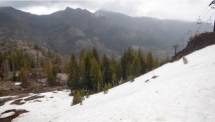
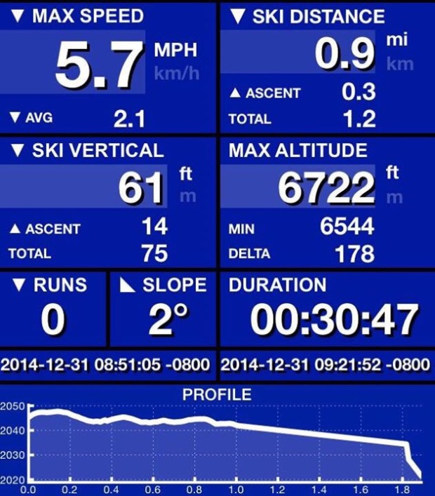
Left my friends house in Verdi, Nevada at 7 AM, where it was chilly 2 degrees. All of my bottles of water in the car were frozen solid. I headed up to Tahoe Donner ski area to meet up with Helen from the Donner Party Mountain Runners. From there we carpooled up the hill to start our run for the morning.

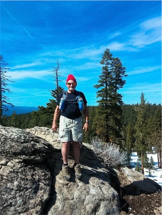
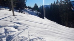
It was a nice straight run, a couple of rolling hills to get up which made me gasp for air early on. Helen came back to check on me as I was bringing up the rear of the group. The 5° temperatures made your nose and lungs burn a little bit until you got used to the cold air. Except for that, the conditions were flawless, not a cloud in sight, snowshoe running on a perfectly groomed trail. I got about half to three quarters of the way until I stopped wait up for the group to double back. Ran with Helen a little bit more, and then we all met up at the house for some hot cider and a warm fireplace.

Though it’s still the 31st, I’ll call it a great start for the New Year.

/home/wpcom/public_html/wp-content/blogs.dir/57f/75238959/files/2014/12/img_2722.jpg

/home/wpcom/public_html/wp-content/blogs.dir/57f/75238959/files/2014/12/img_2724.jpg

/home/wpcom/public_html/wp-content/blogs.dir/57f/75238959/files/2014/12/img_2723.jpg

/home/wpcom/public_html/wp-content/blogs.dir/57f/75238959/files/2014/12/img_2720.jpg

/home/wpcom/public_html/wp-content/blogs.dir/57f/75238959/files/2014/12/img_2715.jpg

/home/wpcom/public_html/wp-content/blogs.dir/57f/75238959/files/2014/12/img_2719.jpg

/home/wpcom/public_html/wp-content/blogs.dir/57f/75238959/files/2014/12/img_2721.jpg

/home/wpcom/public_html/wp-content/blogs.dir/57f/75238959/files/2014/12/img_2718.jpg

Christmas Eve Snowshoeing at Royal Gorge

RoyalGorge_Map-2014-16×9

Had so much fun last week, and we had a storm since, I headed back up to Royal Gorge Cross Country Ski area for more snowshoeing. What I didn’t expect, the snow on the trees from last week and the storm melted already by the time I got back up. Plenty on the ground, with beautiful blue skies, I started out down the Yuba Trail. I had to make a few of my own tracks though in some large mounds of untouched powder…well, untouched until I got there.

I did test my next step each time I trotted out into the ungroomed snow. (Prod ahead with your poles to make sure that there are no holes or branches you could fall into or get your foot caught on) Once back on the groomed portion, I tried to pick up my pace a bit and run in my snowshoes. A couple of trips to start out, but got the form and the pace quickly. With the altitude it didn’t last long before resuming my walking pace. Always takes me a few miles to get my legs and my wind before I’m good to go.

From Yuba, I picked up Sidewinder, went down Fast Draw to Hawk’s Run (both snowshoe trails, but had not been groomed yet, so it was a little slow going but great to be in the powder!) Finally back to Sidewinder, I took a right on Sleigh Ride, a large wide open area, well groomed that follows the power lines down the hill.

Arriving at a crossroads for several trails, (Palisade, Stagecoach, Snow Mountain and Hi Jinx) I took a short jog to the right then quick left to pick up the Maintenance Road. It had crusted over after the Snowcat was over it, so it was a little crunchy to walk on. It did provide some beautiful, untouched areas with up close views of small streams flowing through the snow and under the road. I was the only one around, so I took my time about getting back on track to the groomed areas. I will get an earlier jump on the trails next time so I can get down Stage Coach, a long and scenic trail passing close to Deer Lake.

Back on Palisade Trail now, I walked as far as Killy’s Cruise, taking me back to Lyle’s Lookout where I was the week before. This time, the views were more beautiful as the skies were clear and blue with no impending storm clouds. Someone had made a small snowman I called”Lyle” and had to take a selfie of us before leaving. The sun was getting lower in the sky pretty early now, with sunset at 16:41. It was already 15:00 (3 pm), and time for me to start making tracks for the Summit Station. It was getting pretty chilly and crusty in the shaded areas of the trail. Met some nice folks to chat with at Palisade and Rodney’s Run.

There was a nice, snow-covered pile of logs that was very picturesque and I had to take the photo opportunity while I had it. Palisade took me all the way back to the Summit Station, but it was just too nice to leave yet. I took off my snowshoes and sat in a big mound of snow and ate my crunchy apple, and sipped my cold bottle of carrot juice. The view, breathing in the cold fresh air and the solitude of being back in the mountains reminded me of several of the many sayings of John Muir…

“Another glorious Sierra day in which one seems to be dissolved and absorbed and sent pulsing onward we know not where. Life seems neither long nor short, and we take no more heed to save time or make haste than do the trees and stars. This is true freedom, a good practical sort of immortality.”
― John Muir, My First Summer in the Sierra

“Going to the mountains is going home.”
― John Muir

See you soon on my next adventure in the Tahoe Wilderness

TahoeMarmot2 copy-resized copy

Royal Gorge Cross Country Ski Resort – Snowshoeing

Sunday, December 14, 2014

RoyalGorge_Map-2014-16×9

With 8.5″+ of rain in the north bay area of Marin County, it was time to head for the mountains and be the first to make my tracks in some fresh powder. The storms that dropped snow in the Sierra’s were mostly at higher elevations, near Donner Summit. Lake Tahoe level did not get any of the moisture as snow, but mostly rain.

Last October I rode my bike past the Royal Gorge Cross Country Ski area, just past Soda Springs Ski Resort. Royal Gorge caters to Cross Country Skiers and snowshoer’s, with groomed and virgin snow trails to spend the day on. The terrain features gentle rolling trails, with some that would have you gasping by the time you made the summit of the trail. There are no ski lifts here to rely on to get up the hill, only your lungs and raw leg power. You won’t find any snowboarders here either, only those that are looking for some back country peace and quiet, and hard-core cross country athletes out for an intense workout.

For those of you that may wonder if you can snowshoe or not…if you can walk, you can be snowshoeing in less than 10 minutes. It doesn’t really require a learning curve or much special equipment or clothing like skiing does.  Most of your equipment you can rent from the resort or REI and other sporting goods stores. I will make a list of recommended items to bring for safety and comfort and convenience at the end of this post.

From Highway 80 driving East, take the Exit number 174, Soda Spring Exit. Follow the sign to Royal Gorge, just beyond the Soda Springs Ski area. The resort opens at 08:30 am and closes at 4:00 pm daily. You can get a slight discount if you start your day after 1:00 pm. Seniors do get a small discount, but not worth mentioning.

Since they had only been open for one day for the season, not all of the trails had been groomed for use. There are several snowshoe only trails, but they were not ready for the season. You can use the ski trails if you stay to the right of the trail and out of the ski tracks in use. I met a lady that was local to the area on snowshoes as well, and I just made friends with her and chatted while we walked along the trail.

The route we took was down James Joy to Killy’s Cruise and out to Lyle’s Lookout. From there a panorama opened up to see Devil’s Peak and the Royal Gorge to the southwest.

Dark storm clouds were also looming in the distance to the southwest, so we took our photos and rejoined the trail at Crosscut and Palisade Trails. From there we parted ways and I took the maintenance road returning to the lodge and parking lot. Along the way were gorgeous wintery scenes looking like picture postcards everywhere I looked. The snow piled up so deep on the branches of the pine and fir tree, I don’t know how they didn’t break.

Being an aspiring trail runner, I can run 10 to 15 miles at sea level no problem. But now at altitude again, wearing clumsy snowshoes, I will barely make 2 miles today when I’m done. Snowshoeing is a very aerobic sport, and you will be exerting a lot of energy and getting quite warm. Make sure to dress in layers, so that you can remove a layer or two when you work up a sweat, then put them back on when you stop for a rest.

The snow was quite fluffy, and the new deep powder was calling my name to venture out and make my own trail.This is where a word of caution is needed. With new snow, the dangers of skier provoked avalanches are probable. So before you get too adventurous, arm yourself with a little knowledge, free of charge.

The Sierra Avalanche Center evaluates areas for avalanche danger and posts it to their website. The information is invaluable and is free of charge. You can visit the website and learn about avalanche dangers, and classes that are offered in avalanche awareness if you plan on any backcountry trips by yourself or in a group.

Well, the Maintenance Road back to the lodge was quite a workout, as it’s made for the snowcat to use, so a steep incline is not a problem. I was sweating bullets by the time I got to the top, and that was what I wanted. This was a workout day like any other, and I did’t come here for a walk in the park. I wished that I could have stayed longer, but the snow was starting to fall. Soon it would be a white winter wonderland, with slick roads and chain requirements. That is not the fun part of winter travel, so I got back on the highway while I still could.

I will return to Royal Gorge soon, for another day or two’s snowshoeing adventures. Anyone wishing to join me or put a group together to have a snowshoe and picnic day at Royal Gorge, feel free to contact me on this website.

I look forward to seeing you soon, on more adventures in the Tahoe Wilderness.

TahoeMarmot2 copy-resized copy

Eagle Lake & Mt. Tallac – January Snow

Newly fallen snow in Tahoe was all I could think of to celebrate my birthday with. Had a bad bout with the flu, but I had already paid for my fancy hotel room at the Grand Residences Marriott in Heavenly Village, South Lake Tahoe. I was not about to just lie around in front of the fireplace and not go play in the snow. It was snowing all the way over Echo Summit and down to the lake. There was still plenty of daylight left, so I went directly to the Eagle Falls Trailhead near Emerald Bay. About 8 miles north on Highway 89 from the “Y” in South Lake Tahoe, where Highway 50 and 89 meet. Parking is across the road from the Vikingsholm parking lot on Highway 89. If there is not enough space, park at Vikingsholm and walk (run) across the road to the trailhead. Before leaving the parking area, hike below the road on the Vikingsholm side, as the waterfall below the road is worth the effort to get there.

Once at the trailhead, the trail is not as easy to find with the accumulated snow from the past few storms. A little GPS, a little memory, and a little luck I found my way back to the lake. It’s only about one mile each way, about 20 to 30 minutes without snow in spring and summer. (If you wish to camp overnight in the Desolation Wilderness, you need to buy a permit from the Ranger Station in South Lake Tahoe or the Pacific Ranger Station in Pollock Pines on your drive up. You can also get a permit online at Recreation.gov. California Campfire Permits are also needed for camp stoves, and there are no open fires allowed in the Desolation Wilderness.)

Topo Map of Area

http://caltopo.com/map.html#ll=38.94707,-120.11198&z=15&b=t&o=r&n=0.3

The snow was getting heavier and the wind picking up right behind it. After leaving the bridge and stones, the trail turned to snow about 6 inches deep. It was now time for the snowshoes. I met several guys coming back out from the lake also in snowshoes. They told me that they were the only ones back there, so I kept that in mind going back to the lake, another half mile in the snow. I do crazy things, but not stupid things…since I was the only one that knew I was back here, I didn’t get overly adventurous and leave the trail.

After dipping my hand in the cold lake and admiring the icicles cascading down from the rocks, it was time to make track back to the car. The snow was coming down a little heavier now; gusts of wind would send it sideways into my face or down the hood of my parka. It was still plenty warm, even working up a sweat trudging through the gathering snowdrifts back to the parking area. One last look and picture of snow falling over Emerald Bay before I go.


TahoeMarmot2 copy-resized copy

As always, another day, another adventure…

This time I’m off to Mt. Tallac, between Emerald Bay and Fallen Leaf Lake, Mt. Tallac is one of the most recognizable peaks in the Tahoe Basin, with a “T” or cross of snow below the peak in the spring and winter months. Rising above the lake at 9,735 feet from near lake level of 6,480’ at the trailhead, Mt. Tallac is about 4.8 miles to the summit. The views are some of the most spectacular in all of Tahoe, as you have unobstructed 360° views of the lake, the Carson Range to the east and Desolation Wilderness and Crystal Range to the west, and the Granite Chief Wilderness to the southwest and northwest. At this time of year, the metal barrier was not open yet for the season, allowing me to drive to the trailhead, about one mile up the paved access road. I parked my car near the roadside of the Mt. Tallac turnoff and Highway 89 and walked the extra distance. I started out wearing my Kahtoola Micro-spikes, as the snow and slush became icy in the shadowy sections of the road. Not long after first light, I was at the trailhead. I filled out my Desolation Wilderness Day Permit (instructions are at the trail sign), attached it to my daypack and was on my way.

It had snowed just yesterday, and the freshly fallen snow on the branches of the pine trees looked like Christmas trees, more than I could count. I was once again in a “Winter Wonderland” in one of my favorite places on earth.

The trail is fairly level for a half mile or so, until you begin to climb to the ridge between Fallen Leaf Lake and Cascade Lake. The higher elevation starts to open up views of Fallen Leaf, Lake Tahoe, the Carson Range and Heavenly Valley as you climb along the ridge line. The ridge is quite rocky most of the year and difficult to walk on. This time with snow and snowshoes, it seemed a little easier oddly enough. Once dropping down from the west side of ridge, the trail winds down and behind into a wooded section, deep in powder this trip to Tallac. After about 1½ miles, you arrive at Floating Island Lake, frozen over this time of year.

Looking up directly at Mt. Tallac peering down on you, the southeast chutes are visible for those die-hards that want to avoid the crowded trail in the summer, or ski down the gnarly face in the winter and spring.

About ¾ mile after Floating Island Lake, you emerge from the forested area of the trail at Cathedral Lake. A beautiful yet small lake, nestled in a rocky moraine at the foot of Cathedral Peak – this is a good place for a rest and a bite to eat before tackling the big climb that awaits you to the ridge.

The trail becomes quite rocky and steep much of the way up to Mt. Tallac. There are several switchbacks up the mountain, but it still quite steep and challenging any time of year. It is quite a cardio workout even if you don’t do the entire 3,300 feet of climbing to the summit of Tallac. After many stops to catch my breath, photo ops and just taking in the grandeur of the sights below me, I finally made it to the ridge. The saddle branches off at a trail junction, one direction continuing on to the summit of Mt. Tallac, the other, down the back side of the mountain to Lake Gilmore, deep in the Desolation Wilderness. That trip will have to wait until summer, when the snow and low temperatures melt away with the warm sunshine and more livable conditions.

The usual 6 hour, 4.8 mile hike has taken me that long to get nearly half way in the snow. I will not summit today, as I need to get off the mountain before nightfall. I hadn’t planned on being this slow, and did not bring my Petzl headlamp with me to hike after dark. Now to slog down the switchbacks in snowshoes – I actually think it was easier going up. Snowshoes were not designed to sideways, and it’s a killer on the ankles trying to do that. OK, I’m past Cathedral now, so the real steep past is past. Another hour plus getting out of the shade of the forested section and past Floating Island Lake, and I’ll be on the open ridge above Fallen Leaf Lake and in the sunshine. I came upon a couple with their dog, that must have turned around backtracking to their car. They didn’t have snowshoes and seemed to be moving faster than I was, so I took mine off and tried that for a while. It was all good until the shady areas turned to ice, and I had to put my Micro-spikes back on before I fell on my butt on the icy sections.

Finally back to the car, I have been out nearly 10½ hours today. Quite an adventure. At least nobody needs to come looking for me. Now, back to my fancy hotel for a sauna and jacuzzi bath tub, cozy in front of my own fireplace – a kitchen to make a nice pot of hot peppermint tea… and a giant king-size bed to fall asleep in.

After all…this was my birthday weekend to play in the snow – flu or no flu
I had another fun-filled vacation, in the Tahoe Wilderness.

TahoeMarmot2 copy-resized copy

See ya on my next adventure, in the Tahoe Wilderness

Jake’s & Maggie’s Peaks – Snowshoes in April

Fresh powder just fell up in Tahoe and I made a beeline to be one of the first to make some tracks with my snowshoes on some of the north facing peaks on the west shore. Those areas would most likely have the most snow accumulated, not getting much sun light to melt it yet. I decided that I would do two separate outings, Jake’s Peak rising above D.L. Bliss on the west shore on Day 1 and the next day I would do Maggie’s Peaks starting at the Bayview trailhead across from Inspiration Point overlooking Emerald Bay on Day 2.


I arrived at Tahoe city and the weather was perfect. Lows in the 40s highs in the 70s. Crystal clear blue sky… hardly a cloud anywhere. From Tahoe City I drove for about 17 miles south, or a half an hour on a good day, down the West Lake Blvd. to D.L. Bliss State Park and campground. (In case you needed, the TART bus runs down to Bliss also every hour, June to September 1st) The entrance is also several miles north of Emerald Bay. There is a small parking area off of the east side of the road near the entrance to  D.L. Bliss State Park and campground. Well great minds think alike and I wasn’t only one that thought this would be a great idea to go out on the mountain today. About six young “telemarkers” in their 20s climbed up to Jake’s to do some backcountry skiing with the fresh powder. Jake’s is a favorite spot of the locals, kind of like a favorite surfing spot and they get a little territorial as well. Today I only had to contend with the telemark backcountry skiers with climbing skins on their skis. I tried to stay out of the path that they made with their skis, just using their marks as my general direction.

The route starts at at just above lake level, about 6,800 feet, and is nearly straight up the eastern facing slope for about 1.5 to 2 miles up to the main peak which is closer to 9,137 ‘ from my GPS. I doubt if I will get all the way to the top today. The southern route to the ridge is the most popular route to take in the spring time. If it hadn’t recently snowed, the conditions would’ve been typical springtime corn conditions to hike and ski on. This route also gives you an unbelievable view of Emerald Bay from high above. Let’s see how far I get today.

I followed the young skiers’ tracks up through the trees… there wasn’t a defined trail, or if there was it was covered in snow now. My route was straight up the mountain making my own switchbacks along the way when it got too steep and some places. I made sure to look back often and admire the view – that was my primary purpose for being here anyway. Just like my snowshoe trip to Mount Tallac in January for my birthday, everywhere I looked was like a scene from Courier & Ives – snow drifts of fresh powder covering downed trees and boulders, sparkled like glitter in the afternoon sunshine. Behind me, Lake Tahoe lived up to its name as the ”Crown Jewel of the West”…the deep blue water, with snowcapped mountains of the Carson range behind it. With all the smells and colors of the trees, the bright white snow and deep blue sky, it was sensory overload and I was loving every minute of it.

After several hours of climbing, I sat down in the snow to take a little breather – I didn’t even bother taking off my snowshoes. I wasn’t getting anywhere fast today. Soon after returning to my climb, the young telemark skiers zipped on past me, enjoying all that they worked for that morning climbing the mountain. I’m nearly at the top now and gave it another 30 minutes before throwing in the towel and heading back down the mountain. After all, I was the only one up here and no one else knew that. I took my last pictures of the views that I earned on my way up, then made my way back down the trailhead across from D.L. Bliss. I need to go rest up for my next adventure tomorrow, climbing to Maggie Peaks from Bayview Trailhead.

Jake’s on area topo map

http://caltopo.com/map.html#ll=38.96543,-120.10692&z=15&b=t

Another day, another adventure. I parked at the Bayview Trailhead to begin my ascent to Maggie’s Peaks for the day. Getting there early in the morning, it was half slush and half ice. Today I brought my snowshoes, crampons, and my Kahtoola MICROSpikes. The micro spikes were the best thing to start the hike with while walking from snow to ice on the paved road to the trailhead – kept me from falling on my butt mostly. At the trailhead you need to fill out a Desolation Wilderness Permit even for the day, as it gives the Rangers a “heads-up” if they need to come looking for you if you don’t get back before nightfall.

The climb to the saddle between Maggie’s north and south peak is a series of many switchbacks up the side of the mountain. There is a great vista point along the trail, one of the lake in the background and another 100 feet more opens to a beautiful view overlooking Emerald Bay directly below – far more beautiful than the Inspiration Point view could give you… this view you will have to earn by climbing here.

The trail flattens out a bit, meandering through the trees and manzanita brush, eventual bringing you to Granite Lake, nestled at the foot of Maggie’s South Peak. This is another popular spot for backcountry skiers, the real die-hards…but not today. Today I had it all to myself, with the fresh powder from yesterday waiting for me to put the first footprints in for the day. I got down to Granite Lake that looked frozen over, but it was so calm the powder from the day before was just lying on top like goose down feathers – not a breath of wind to disturb it.

The trail was obscured by the snow, though I had been on it before, it was still difficult to know if you were on the trail or bushwhacking your own. After a while, the slope became too steep to walk up. My MSR Ascent snowshoes have “Televators”, like turning your snowshoes into high heels! You pull a little bar up under your heel, so you walk more upright ascending a slope. Many switchbacks later, I made it to the saddle between the north and south peaks.

There, the panorama of the Desolation Wilderness unfolded before me. I could see Phipps Peak and other minor peaks that were hiding the Velma Lakes  and the rest of Desolation behind it. Below me was Eagle Lake, where I had been in January. (Eagle Lake is a short, very easy hike from a trailhead off of Highway 89 across from Vikingsholm and Emerald Bay) Climbing up on a rock, I just took in the incredible “Winter Wonderland” view that I had from the top. Shame I didn’t bring my tent and sleeping bag, as it would have made an awesome sunrise over the Carson Range the next morning. (Technically, I would need an overnight permit from the Ranger Station – I made a mental note to  make sure I camp here next spring)

Ok, time to go home. My light was beginning to fade and I’m already on the shaded side of the mountain. It was easy to find my away back this time. I was the only tracks around to follow down the hill. One final look at Emerald Bay then on down to my car. Walking with snowshoes does take longer than hiking of course, so figure you’re going to make good about half of you hiking speed at best. Less if the drifts are more than about 6” deep.

Maggie’s on area topo map

http://caltopo.com/map.html#ll=38.93419,-120.10477&z=14&b=t&o=r&n=0.3

That concludes another great day in Tahoe… After a hot shower and some dinner, I’ll start planning tomorrow’s great adventure.

TahoeMarmot2 copy-resized copy

See ya on my next adventure…